|
|
The Leading Open Source
Environmental Data Management System
Enviro Data
is a program for storing and displaying site environmental data. This
powerful and intuitive software uses Microsoft Access for the user
interface and any ODBC-compliant database such as Access, SQL Server or
Oracle as a back-end database server. Enviro Data allows users to
import analytical and other data from laboratory data files or printed
reports, review the quality of the data, and then store the data in the
database. The data storage structure (data model) has been carefully
refined over many years based on our experience storing millions of
records of environmental site data, and satisfies the rules of Fifth
Normal Form data structure. The user can select data using a simple
form-based query system to see just the data they need. They can create
a printed report, save the data to disk, or copy it to the clipboard so
they can paste it into another Windows program. The software allows
display of graphs and maps of constituent data, and allows storage of
data from many different sites in the same database. The latest version
adds powerful data verification and validation features, as well as very
flexible report formatting, and, with the Access front end, it is easy
to modify the software for your specific project needs. Enviro Data
is the easiest software of its type to learn and use, even for non
database experts, at a great price! To see more
information on Enviro Data, click here!Enviro Data is available in two versions - Advanced
(single user) and Concurrent |
|

GIS Graphics
 |
|
| Easy and Efficient Display of
Environmental Data in GIS
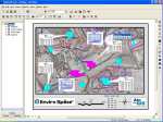
Geotech's new Enviro Spase product makes it easy to display
environmental data from Enviro Data or other sources on GIS maps.
Enviro Spase runs within ESRI's ArcGIS (8.x or newer), and
contains five Wizards to create different types of displays. The Callout
Wizard draws data tables on the map with various options. The Stiff
Diagram Wizard draws water quality diagrams at station locations. The
StickLog Wizard creates boring log displays showing concentration
levels. The Graph Wizard displays time-sequence graphs of multiple
constituents on up to two scales. Enviro Spase is nicely
integrated with Enviro Data's advanced features such as Value and
Flag processing and Regulatory Limits, so you can easily and efficiently
move your data onto your maps, providing the most useful information
while maintaining a high level of quality.
To see more information on Enviro
Spase, click here! |
|
|
Geotech is also an authorized reseller of
mapping
and other graphics programs by
other manufacturers. For more information on the products available
for resale, click on the link below to go to our pricelist page.
To download the pricelist in PDF format, click
here.
For information
on our business partners, click on Strategic
Alliances. |
![]()