PROJECTS
 GEOTECH COMPUTER SYSTEMS, INC.
12150 E. Briarwood Ave., Suite 202, Centennial, CO 80112
(303)740-1999
www.geotech.com
REPRESENTATIVE
PROJECTS
 GEOTECH COMPUTER SYSTEMS, INC.
12150 E. Briarwood Ave., Suite 202,
Centennial, CO 80112
(303)740-1999
www.geotech.com
Superfund Project - Analysis System for Sample Data

Geotech designed and implemented a software program for tracking and analyzing sample data for a Superfund site for a group of Fortune 500 companies. The resulting system allowed the user to interactively select a sample location or group of locations, select a contaminant parameter or group of parameters, and determine non-compliant analyses within a depth range for surface soil, stream sediments, surface water and groundwater. These analyses could then be displayed on the map as color-coded symbols based on parameter-specific cutoffs. Provisions were also provided for storing and manipulating NAPL (non-aqueous phase liquids) data. Another part of the system managed the display of base map information imported from the AutoCAD drafting program, allowing the user to choose which base map and station data would be displayed, and these elements could be turned on and off to emphasize whatever subset of the data was important for a given map. The cost of developing the system was more than offset (by a factor of five-to-one) through savings on clerical time in preparing maps of contaminant locations.
Graphical Front End for Corporate Data
Geotech was a contractor to a leading computer company, assisting in the design and creation of a graphical front-end to corporate data stores resident on mainframes, UNIX workstations, and personal computers. This system provided a global data dictionary which contained information on data types, formats and locations for both digital and hard-copy data. Geotech’s contribution was to the integration of the map-based selection system with the rest of the SQL-based query system (based on a UNIX version of a subset of our Spase software), and in providing and converting base map data for use in the system.
Image Database Project

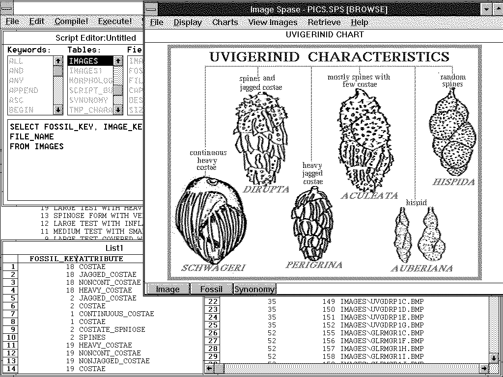
Geotech performed a project which provided a graphical system for managing images of paleontological specimens collected by a major oil company during offshore oil drilling. The resulting program provided a set of diagrams to assist in the identification of specimens based on images stored in the database. These images were captured using a video camera attached to a binocular microscope or were scanned from the literature. They were then cataloged in a relational data model, and access routines provided to allow the user to subset the data based on the information available. They were then able to view "thumbnails" of the subset specimens, and then select an image for full-scale view. This image on the computer screen could then be compared to the image on the monitor attached to the video camera to aid in the identification of the fossil, which was important in monitoring drilling progress. Similar technology can be used to manage documents, drawings and other images associated with project data.
Petroleum Exploration Corporate Database
Geotech provided a software and service solution to a large independent oil company’s needs for a corporate client-server system for managing petroleum exploration and production data. The resulting system provides up to 20 users with access to the corporate database, and allows them to carve out subsets of the data for project use by making graphical selections on maps on the screen. It uses the Spase spatial database manager as the graphical, map-based front-end, and Oracle on a Banyan server as the central repository. This approach can be used with any kind of data which has a map component, and is essentially unlimited in data capacity, while at the same time providing almost instant access to any data in the system.
Grant Environmental Data System
 Geotech staff cooperated with Grant
Environmental in Englewood, Colorado to create the Grant Environmental Data System, a
program for storing and displaying environmental site data. The software uses Microsoft
Access as a front end user interface and any ODBC-compliant database such as Access,
SQLServer or Oracle as a back-end database server. The software allows users to import
analytical and other data from laboratory data files or printed reports, review the
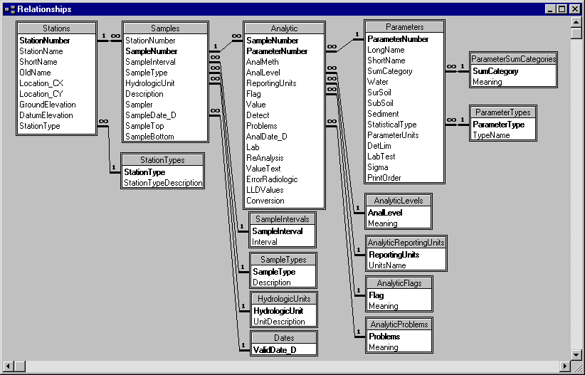
quality of the data, and then store the data in the database. The data storage structure
(data model) has been carefully refined over many years based on our experience storing
millions
 of records of environmental site data, and satisfies the rules of Fifth
Normal Form data structure, as shown in the figure. The user can then select data using a
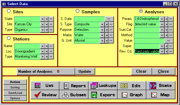
simple form-based query system to see just the data they need. They can then create a
printed report, save the data to disk, or copy it to the clipboard so they can paste it
into another Windows program. Grant uses this software internally for their projects and
has provided it to several clients to use in managing their site data. The latest version
allows display of graphs and maps of constituent data, and allows storage of data fro
 m
many different sites in the same database.
m
many different sites in the same database.
Agricultural Landscape Simulation

In cooperation with Terra Spase in Napa, California, Geotech developed a marketing presentation to illustrate the locations of vineyards and distinct soil types for an Appellation (group of vineyards). This project involved acquiring Digital Elevation Model data and culture data (roads, streams, etc.) from the U.S. Geological Survey, digitizing the soil polygons from hard copy maps, and then using surface modeling software to develop realistic-looking mountains with the other data draped over them.
Volume Modeling of Industrial Facility
In cooperation with Grant Environmental, Inc., Geotech created a three-dimensional model of the values of two radioactive contaminants at an industrial site in the Midwest. Starting with about a thousand borings and several hundred thousand measurements, we used geostatistical software to estimate values in 330,000 three-dimensional blocks. The results of this analysis were used to estimate the volumes of soil at different contamination levels and to generate graphical displays of the contaminant distribution in preparation for site excavation.
Statistical Analysis of Winery Data
Geotech developed a software package to assist in the statistical analysis of chemical and other parameters as grapes and must (wine being made) flowed through the winemaking process. This software assists wine industry analysts determine through statistical analysis what parameters in the vineyard and the winery are important in influencing the quality of the wine. This software automated the process of selecting and organizing the data for the statistics analysis, and presented the results in an easy-to-understand fashion.
Animation for Litigation Support
Geotech personnel created a sophisticated interactive product to support environmental litigation defense. Using state-of-the art graphical and animation software, we created a system for use on the witness stand supporting expert testimony. This system synthesized about 40 gigabytes of reports and other data so that it could be presented in a couple of days. We have also created a number of other animated presentations to help explain complex technical concepts to a non-technical audience.
Internet Applications
Geotech has been active on the Internet for several years, and has created a number of web pages for itself and for clients. We are currently involved in a project to make a large amount of petroleum well data available through interactive selection over the Internet.
Corporate Environmental Data System
Geotech performed a project for a Fortune 500 industrial company to evaluate and satisfy their environmental data management needs for a division of about 80 people. The first stage was to use an interview process to perform a needs assessment. The second was to use the resulting needs to design and build a data management system using Microsoft Access as a front end and Microsoft SQLServer as a back end for storing several million records of environmental site investigation and remediation data. This system integrated data gathered in the field and in the laboratory, and provided both textual and graphical output, including interactive map displays using the SylvanMaps OCX technology.
Remote Access Environmental Database
Geotech performed a project for a national waste management company to provide a corporate database which is available to their staff on a call-in basis. This system, built in Microsoft Access and Microsoft SQLServer, allows the import of data in a variety of formats into a repository in a central location. Company geoscientists can then connect to the database using Microsoft Remote Access Services from any location using standard phone lines. They can then work with the data remotely, or download a specified subset for local analysis and display.